

California · United States
BerkeleyStreet Map Print
37.8713° N — 122.2686° W
A Berkeley street map print in three colorways — an instant digital download of the California college town written out street by street. Shattuck Avenue and Martin Luther King Junior Way run the length of it, Hearst Avenue and Channing Way cross above and below UC Berkeley, and Virginia Street and Parker Street name the flat blocks either side. Strawberry Creek threads through, with Ohlone Park and Live Oak Park in among them. Every street the sheet has room for carries its own name, set along the road it belongs to.
The colorways
One city, three moods
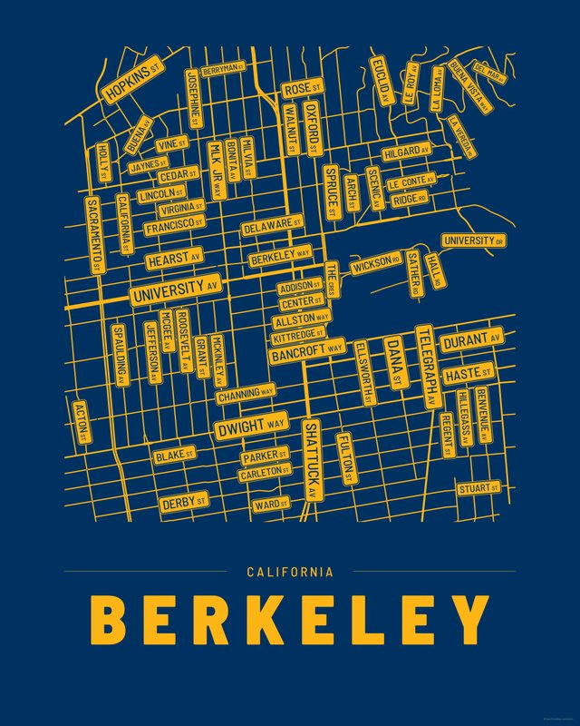
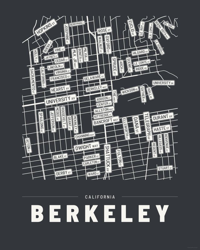
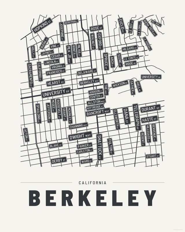
All three come with every purchase — the same Berkeley fits a bright hallway or a moody study, and you can change your mind later.
The details
This print, exactly
- Coverage
- 2.8 km (1.7 mi) across, east to west
- Centred on
- 37.8713° N — 122.2686° W
- Place
- California · United States
- Colorways
- Accent, Ink, Paper — all three included
- Print sizes
- five ratios, each at its largest print size · up to 24×36 in / 60×90 cm
- Files
- vector PDF and 300 DPI PNG
- Price
- $6.29
$8.99— instant download, nothing ships - Map data
- OpenStreetMap · © OpenStreetMap contributors
70 streets are named on the sheet: Acton Street, Addison Street, Allston Way, Arch Street, Bancroft Way, Benvenue Avenue, Berkeley Way, Berryman Street, Blake Street, Bonita Avenue, Buena Avenue, Buena Vista Way, California Street, Carleton Street, Cedar Street, Center Street, Channing Way, Dana Street, Del Mar Avenue, Delaware Street, Derby Street, Durant Avenue, Dwight Way, Ellsworth Street, Euclid Avenue, Francisco Street, Fulton Street, Grant Street, Haste Street, Hearst Avenue, Hilgard Avenue, Hillegass Avenue, Holly Street, Hopkins Street, Jaynes Street, Jefferson Avenue, Josephine Street, Kittredge Street, La Loma Avenue, La Vereda Road, Le Conte Avenue, Le Roy Avenue, Lincoln Street, Martin Luther King Junior Way, McGee Avenue, McKinley Avenue, Milvia Street, Oxford Street, Parker Street, Regent Street, Ridge Road, Roosevelt Avenue, Rose Street, Sacramento Street, Sather Road, Scenic Avenue, Shattuck Avenue, South Hall Road, Spaulding Avenue, Spruce Street, Stuart Street, Telegraph Avenue, The Crescent, University Avenue, University Drive, Vine Street, Virginia Street, Walnut Street, Ward Street, Wickson Road.
Print sizes
All included
- 12×18 · 16×24 · 24×36 in 30×45 · 40×60 · 50×75 cm
- 9×12 · 18×24 · 24×32 in 30×40 · 45×60 · 60×80 cm
- 8×10 · 16×20 · 24×30 in 20×25 · 40×50 · 60×75 cm
- A4 · A3 · A2 · A1 21×30 → 59×84 cm · fits IKEA / A-size frames
- 11×14 · 22×28 in 28×36 · 56×71 cm
Every purchase contains all three colorways in all five sizes, as vector PDF and 300 DPI PNG — an instant digital download on Etsy. The PDF is drawn, not rasterised, so it prints crisp at any size. Nothing ships; you print it your way.
The other edition
Also drawn as a map
The same city drawn as a quiet minimalist map, in three colorways.
Keep exploring
More cities
Three colorways · five sizes
Take Berkeley home
Instant digital download — nothing ships, no frame included.