

Ohio · United States
OxfordStreet Map Print
39.5106° N — 84.7395° W
An Oxford street map print in three colorways — an instant digital download of the Ohio college town written out street by street. East High Street runs the width of it with South Main Street and South Campus Avenue crossing, and Miami University filling the blocks below. South Locust Street and South Patterson Avenue name the campus edges, Four Mile Creek slips past the east, and Central Quad and Bishop Woods sit green in the middle. Every street the sheet has room for carries its own name, set along the road it belongs to.
The colorways
One city, three moods

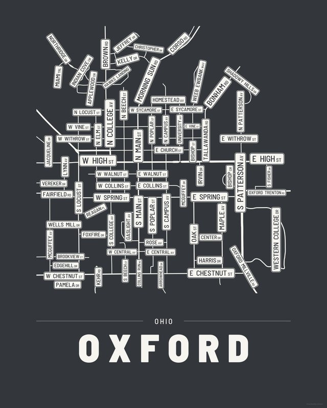
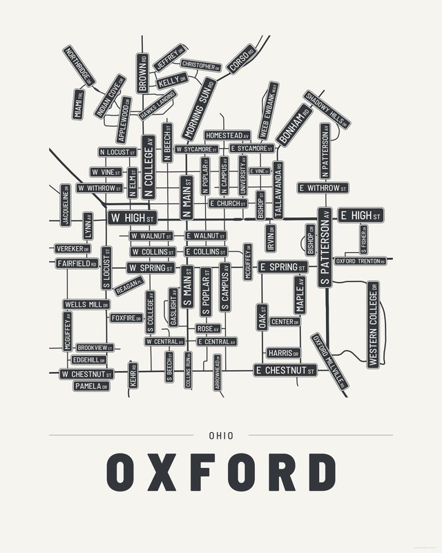
All three come with every purchase — the same Oxford fits a bright hallway or a moody study, and you can change your mind later.
The details
This print, exactly
- Coverage
- 2.5 km (1.6 mi) across, east to west
- Centred on
- 39.5106° N — 84.7395° W
- Place
- Ohio · United States
- Colorways
- Accent, Ink, Paper — all three included
- Print sizes
- five ratios, each at its largest print size · up to 24×36 in / 60×90 cm
- Files
- vector PDF and 300 DPI PNG
- Price
- $6.29
$8.99— instant download, nothing ships - Map data
- OpenStreetMap · © OpenStreetMap contributors
79 streets are named on the sheet: Applewood Circle, Arrowhead Drive, Bishop Circle, Bishop Street, Bonham Road, Brookview Court, Brown Road, Center Drive, Christopher Drive, Collins Run Road, Corso Road, East Central Avenue, East Chestnut Street, East Church Street, East Collins Street, East High Street, East Rose Avenue, East Spring Street, East Sycamore Street, East Vine Street, East Walnut Street, East Withrow Street, Edgehill Drive, Fairfield Road, Foxfire Drive, Gaslight Avenue, Harris Drive, Hawks Landing, Homestead Avenue, Indian Cove Circle, Irvin Drive, Jacqueline Drive, Jeffrey Drive, Kehr Road, Kelly Drive, Lynn Avenue, Maple Avenue, McGuffey Avenue, McGuffey Drive, Miami Trail, Morning Sun Road, North Beech Street, North Campus Avenue, North College Avenue, North Elm Street, North Locust Street, North Main Street, North Patterson Avenue, North Poplar Street, Northridge Drive, Oak Street, Oxford Millville Road, Oxford Trenton Road, Pamela Drive, Reagan Place, Shadowy Hills Drive, South Beech Street, South Campus Avenue, South College Avenue, South Fisher Drive, South Locust Street, South Main Street, South Patterson Avenue, South Poplar Street, Tallawanda Road, University Avenue, Vereker Drive, Weeb Ewbank Way, Wells Mill Drive, West Central Avenue, West Chestnut Street, West Collins Street, West High Street, West Spring Street, West Sycamore Street, West Vine Street, West Walnut Street, West Withrow Street, Western College Drive.
Print sizes
All included
- 12×18 · 16×24 · 24×36 in 30×45 · 40×60 · 50×75 cm
- 9×12 · 18×24 · 24×32 in 30×40 · 45×60 · 60×80 cm
- 8×10 · 16×20 · 24×30 in 20×25 · 40×50 · 60×75 cm
- A4 · A3 · A2 · A1 21×30 → 59×84 cm · fits IKEA / A-size frames
- 11×14 · 22×28 in 28×36 · 56×71 cm
Every purchase contains all three colorways in all five sizes, as vector PDF and 300 DPI PNG — an instant digital download on Etsy. The PDF is drawn, not rasterised, so it prints crisp at any size. Nothing ships; you print it your way.
Keep exploring
More cities
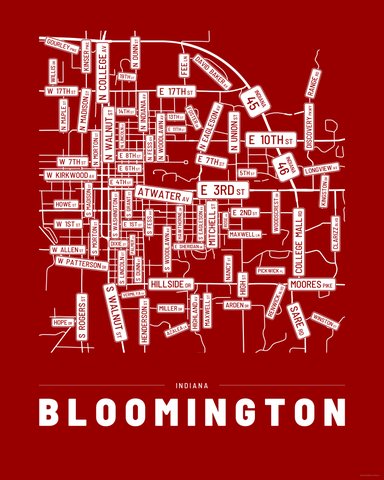
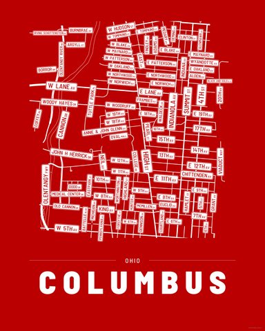
Three colorways · five sizes
Take Oxford home
Instant digital download — nothing ships, no frame included.